

+ 106
Appalachian Trail: McAfee Knob Trailhead to Blackhorse Gap (McAfee Knob, Tinker Cliffs)
Hiking Trail
Hard
33.67 mi
7,880 ft
The iconic AT segment home to McAfee Knob and Tinker Cliffs.
This iconic segment is arguably the most scenic stretch of the 2,200-mile Appalachian Trail. Home to McAfee Knob and Tinker Cliffs, this is a true gem and memorable landmark for thru-hikers and day hikers. Adjacent to the small town of Catawba, Virginia, a moderately sized trailhead serves as the southern terminus.
From the south, McAfee Knob is a 4-mile one-way hike from the trailhead. The northern approach from a small parking lot on US-220 in Troutville is another option, but it measures 16 miles one way. Combined, this portion is roughly 20 miles, making it a great opportunity for a shuttle. This would also make for an excellent route for an experienced trail runner.
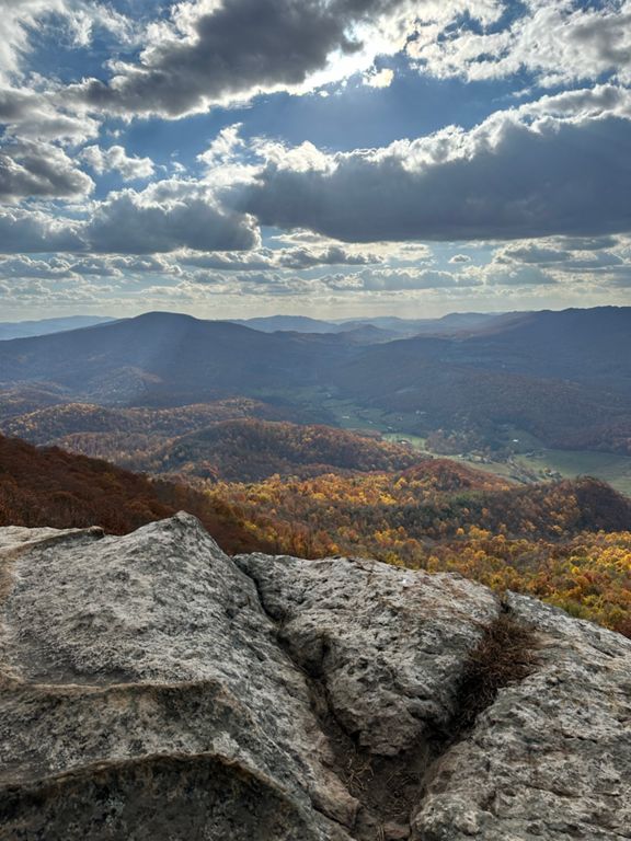
Named after a Scottish-Irish immigrant, McAfee Knob stands 1,600' above the valley floor. Considered the most photographed point along the Appalachian Trail, this unique rocky outcropping draws in countless visitors each year. Expect to spend some time enjoying the 270° views from the formation.
Most popular in the spring and fall, hiking in the winter will provide a completely unique experience. Very few people visit during the colder months, and ice and snow can often be present. With the proper gear, you could have this stretch of trail all to yourself—a bold contrast to the busier months.
Though it would seem like an excellent spot to camp, several areas are off limits in an effort to preserve their beauty. Additionally, no camping or campfires are permitted around McAfee Knob. According to Wikipedia, "...the only legal campsites are Johns Spring Shelter, Catawba Shelter and campsites, Pig Farm campsite, Campbell Shelter, and Lambert’s Meadow Shelter and campsites".
Continuing north on the AT, the trail follows the spine of the mountain as it traverses to Tinker Mountain, home of the Tinker Cliffs. This formation, along with McAfee Knob and Dragon's Tooth, form Virginia's Triple Crown for hikers.
The Andy Layne Trail is an alternative and shorter approach to the cliffs and can be a great option for a quick day hike.
After reaching US-220 and crossing under Interstate 81, the trail climbs and traverses a lower-elevation range as it makes its way into the Blue Ridge Parkway corridor. A small pull-off at Blackhorse Gap serves as the northern trailhead for this segment.
Know that in the winter, this region may be hard to access. The Blue Ridge Parkway frequently closes in cold or otherwise inclement weather.
Sources:
Written by Brendon Voelker
Route and Elevation
Segments
| Name | Distance | Elev. Diff. | Avg. Grade |
|---|---|---|---|
| McAfee Knob AT from Parking Lot | 4.15 mi | 1,276 ft | 5.6% |
| Catawba Valley Dr Climb | 0.27 mi | 154 ft | 10.8% |
| Blazin a Fire Road | 3.78 mi | 1,093 ft | 5.4% |
| Mc Afee'S Knob Trail Climb | 0.51 mi | 197 ft | 7.0% |
| Mc Afee'S Knob Trail Climb | 0.31 mi | 148 ft | 8.8% |
| McAfee Knob, AT/Fire Rd. Intersection Climb | 1.36 mi | 787 ft | 10.9% |
| Appalachian Trail Climb | 0.47 mi | 151 ft | 6.0% |
